
Rainbow Lakes Trailhead is a popular mountain access point near Nederland, Colorado, leading into the Indian Peaks Wilderness and toward the scenic Rainbow Lakes. The trailhead also provides access to the Arapaho Glacier Trail, making it useful for both short hiking trips and longer wilderness adventures.
The main Rainbow Lakes hike is relatively short, but visitors should not underestimate the elevation. The trailhead sits around 10,000 feet, the access road is unpaved and seasonal, and mountain weather can change quickly. Planning the drive, parking, trail conditions, and wilderness requirements is just as important as knowing the hiking distance.
Rainbow Lakes Trailhead at a Glance
| Feature | Details |
| Location | Near Nederland, Colorado |
| Managing agency | U.S. Forest Service, Boulder Ranger District |
| Wilderness | Indian Peaks Wilderness |
| Rainbow Lakes Trail | About 1.2 miles one way to the last lake |
| Trail elevation | About 10,000 to 10,250 feet |
| Trail surface | Dirt and mountain terrain |
| Dogs | Allowed on leash |
| Parking | Designated trailhead parking; current pass requirements should be checked |
| Facilities | Vault toilet |
| Drinking water | Not available at the trailhead |
| Road access | Seasonal, unpaved |
| Nearby camping | Rainbow Lakes Campground |
| Other major route | Arapaho Glacier Trail |
The U.S. Forest Service lists Rainbow Lakes Trail at 1.2 miles one way from the trailhead to the last Rainbow Lake, with the trail climbing from approximately 10,000 feet to 10,250 feet. Current Colorado trail data also identifies the route as trail #918 and confirms that dogs must be leashed.
Where Is Rainbow Lakes Trailhead?

Rainbow Lakes Trailhead is near Nederland in Boulder County, Colorado. It sits east of Rainbow Lakes Campground and provides access into the Indian Peaks Wilderness. The official trailhead coordinates listed by Colorado’s trail system are approximately 40.009713° N, 105.569° W.
The trailhead is associated with Rainbow Lakes Road, a forest road leading into the mountains from the Highway 72 area.
One important detail is that Rainbow Lakes Trailhead and Rainbow Lakes Campground are not the same location. The trailhead is located before the campground when approaching the area, while the campground is farther along Rainbow Lakes Road.
Knowing this distinction can make navigation much easier, especially if you are using a mapping application that displays both locations.
How to Get to Rainbow Lakes Trailhead
From the Nederland area, visitors generally travel north along Colorado Highway 72 before turning west toward Rainbow Lakes Road.
The access road is also identified as Forest Road 298 and Colorado trail data identifies Rainbow Lakes Road as route #116.0. It is an unpaved road with seasonal vehicle access.
Once you leave the highway, the character of the trip changes. Instead of a normal paved mountain drive, you are entering a forest-road environment where conditions can vary with rain, snow, mud and other weather factors.
Rainbow Lakes Road Conditions
Rainbow Lakes Road is unpaved, and its accessibility changes during the year. Colorado’s current trail information identifies the road as an unpaved route with seasonal highway-vehicle access.
The road should therefore be treated as part of the adventure rather than an ordinary approach road.
Before leaving, check:
- Current road status
- Recent weather
- Snow and ice conditions
- Mud or drainage problems
- Vehicle clearance requirements
- Seasonal closures
- Parking availability
A vehicle that handles paved mountain roads well is not necessarily the best choice for an unpaved forest road.
What Vehicle Do You Need?
Vehicle requirements can vary with conditions.
The Colorado Mountain Club and trail-user information recommend high-clearance vehicles for the rough road, particularly when conditions are difficult.
A high-clearance SUV or truck is generally the more sensible choice when road conditions are uncertain. A low-clearance vehicle can be a poor choice because rocks, ruts, drainage channels and changing road conditions can make the drive more difficult.
Do not assume that a road being technically open means it will be comfortable for every vehicle.
Rainbow Lakes Trailhead Parking and Passes
Parking is one of the most important practical considerations when visiting Rainbow Lakes Trailhead.
The current Recreation.gov listing provides a dedicated Rainbow Lakes Trailhead Day Pass for the designated parking area. The pass is valid only for the date and vehicle specified and does not guarantee that a parking space will be available. Visitors are also warned against parking outside designated areas because illegal parking can result in fines or towing.
Because parking policies can change, check the current Recreation.gov listing before your trip rather than relying on an old price or rule found elsewhere.
Does a Parking Pass Guarantee a Space?
No.
A valid pass allows you to use the applicable parking area under the current rules, but it does not guarantee that a space will be waiting when you arrive.
This makes an early start particularly useful during popular summer and fall periods.
What About Cell Service?
Cell connectivity can be limited in the surrounding forest. Recreation.gov specifically recommends planning ahead and downloading the necessary information before arrival.
For that reason, it is smart to have:
- An offline map
- Driving directions saved
- Your parking confirmation available offline
- Emergency contact information
- Weather information checked before departure
Do not depend entirely on a live phone connection once you are deep into the forest.
Rainbow Lakes Trail Hike
Rainbow Lakes Trail is a short route compared with many Indian Peaks Wilderness hikes, but its high elevation gives the experience a distinctly alpine character.
The U.S. Forest Service lists the trail at approximately 1.2 miles one way from the trailhead to the last Rainbow Lake. The elevation rises from about 10,000 feet at the trailhead to roughly 10,250 feet at the highest Rainbow Lake.
Some hiking platforms calculate the complete out-and-back route at approximately 2.6 miles, so mileage can differ depending on exactly what portion of the trail is being measured.
Rainbow Lakes Trail Distance
For practical planning, think of the main route as:
- About 1.2 miles one way
- About 2.4 miles for a simple out-and-back using the Forest Service’s one-way measurement
- Some mapping platforms list approximately 2.6 miles out and back
The difference is not necessarily an error. Mapping services can calculate routes differently depending on the endpoint and route data.
Elevation and Difficulty
Rainbow Lakes Trail is often described as an easy hike based on distance and elevation gain. Current trail listings place the route at roughly 293 to 341 feet of elevation gain, depending on the mapping source.
However, calling it simply “easy” can be misleading.
The trail begins at approximately 10,000 feet. Someone accustomed to low-elevation hiking may find the same short climb considerably more tiring than expected.
The hike can therefore be considered:
- Short in distance
- Moderate in altitude exposure
- Manageable for many recreational hikers
- More demanding for visitors who are not acclimated
- Potentially harder in snow, mud or poor weather
Your pace should be based on conditions and how you feel rather than on the trail’s rating alone.
How Long Does Rainbow Lakes Trail Take?
Trail databases report hiking times of roughly an hour for the main route, but actual times vary considerably.
Allow extra time if you plan to:
- Photograph the lakes
- Watch wildlife
- Take frequent breaks
- Fish
- Hike with children
- Adjust to the altitude
- Explore around the lakes
- Deal with wet, rocky or snowy conditions
The drive to the trailhead also needs to be included in your day plan.
What Is the Rainbow Lakes Trail Like?
The route travels through a high-elevation forest before reaching the Rainbow Lakes area.
Rather than leading to a single isolated lake, the trail provides access to a series of connected lakes and beaver ponds beneath the Continental Divide. Hiking sources describe the area as a scenic alpine destination with opportunities for fishing, wildlife viewing and photography.
The surroundings can include:
- Evergreen forest
- Alpine lakes
- Beaver ponds
- Mountain views
- Rocky terrain
- Wetland areas
- Wildlife habitat
The combination of relatively short hiking distance and high-country scenery is one of the main reasons Rainbow Lakes is attractive to visitors.
What You’ll See at Rainbow Lakes
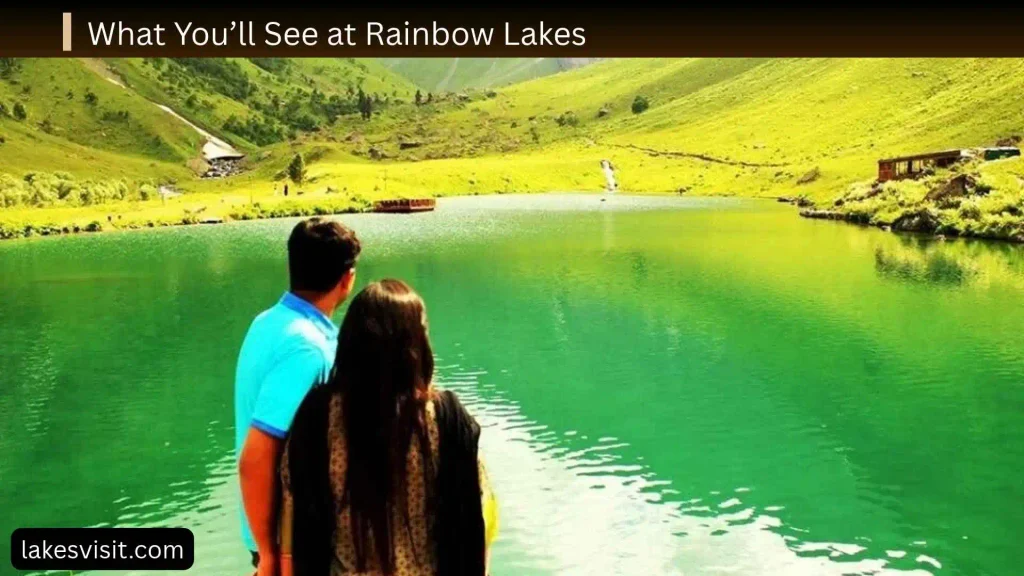
One of the most appealing features of the destination is the collection of lakes rather than a single water body.
The U.S. Forest Service identifies the route as ending at the last Rainbow Lake after approximately 1.2 miles. Hiking information describes the broader destination as a group of connected lakes and beaver ponds.
Alpine Lakes and Beaver Ponds
The lakes sit in a broad mountain setting beneath the Continental Divide.
Beaver ponds add another layer to the landscape, creating wet areas that support wildlife and provide interesting photography opportunities.
The appearance of the area can change dramatically by season. Summer may bring open trails and greener vegetation, while autumn can introduce golden foliage and colder mornings.
Wildlife Viewing
Wildlife is another reason people visit the Rainbow Lakes area.
Possible sightings can include mountain wildlife around the forest and wetland environment. However, wildlife sightings are never guaranteed.
If you see an animal:
- Keep your distance
- Do not approach or feed it
- Keep dogs under control
- Avoid blocking its route
- Use a zoom lens instead of moving closer
The goal is to observe wildlife without disturbing it.
Fishing at Rainbow Lakes
Fishing is a popular activity associated with Rainbow Lakes. Current hiking information describes the lakes as a destination for anglers as well as hikers and campers.
If you plan to fish, check current Colorado fishing regulations before your trip, including license requirements, seasonal restrictions and any special rules applying to the specific waters.
Do not assume that regulations from another Colorado lake apply here.
Other Trails From Rainbow Lakes Trailhead
Rainbow Lakes Trail is not the only reason to use this trailhead.
The U.S. Forest Service identifies the trailhead as an access point for both the Rainbow Lakes Trail and Arapaho Glacier Trail. The Arapaho Glacier Trail heads north from the trailhead and enters the Indian Peaks Wilderness.
This is important for trip planning because the short Rainbow Lakes hike and a longer wilderness objective are very different experiences.
If you are planning to continue beyond the shorter lake route, research:
- Total distance
- Elevation gain
- Weather exposure
- Wilderness regulations
- Navigation
- Water availability
- Overnight permit requirements
- Current trail conditions
Do not use the difficulty of the short Rainbow Lakes route as an indication of the difficulty of longer trails from the same trailhead.
Camping Near Rainbow Lakes Trailhead
There are two different camping considerations: the developed Rainbow Lakes Campground and overnight wilderness camping.
Rainbow Lakes Campground
Rainbow Lakes Campground is near the trailhead and is a separate developed camping facility.
Recreation.gov currently lists the campground as operating from approximately mid-June through mid-September. It has 18 first-come, first-served campsites and does not accept reservations through Recreation.gov.
The campground provides basic facilities including:
- Picnic tables
- Fire grates
- Vault toilets
- Trash service
- Tent pads at designated sites
However, there is no drinking water, electricity, hookups, dump station or showers. Visitors are specifically advised to bring their own water.
The campground can fill quickly on busy weekends, so arriving early is important.
Wilderness Camping
Camping inside the Indian Peaks Wilderness is different from staying at the developed campground.
Overnight wilderness trips can require permits, and requirements can change according to season, location and group size. Recreation.gov currently lists Indian Peaks Wilderness overnight permits among the available permits for the area.
Always check the current Forest Service and Recreation.gov rules before planning an overnight wilderness trip.
Best Time to Visit Rainbow Lakes Trailhead
The best time depends on what kind of experience you want.
Summer
Summer generally provides the most practical conditions for a conventional visit.
Advantages can include:
- Better vehicle access
- More accessible trails
- Warmer daytime temperatures
- Open camping season
- Easier lake access
Even in summer, mountain weather can change quickly, so carry layers and check the forecast.
Early Fall
Early fall can be an excellent time for cooler hiking temperatures and seasonal color.
The higher elevation means conditions can become cold quickly, particularly in the morning and evening.
Do not wait until late in the season to check access conditions. Snow and freezing temperatures can arrive early in the mountains.
Winter
Winter changes the experience completely.
Rainbow Lakes Road is seasonally closed to normal vehicle traffic. Recreation.gov states that the road to the campground is closed for winter and typically reopens in June.
The Forest Service’s winter trail information describes Rainbow Lakes Road as a route for activities such as snowshoeing and cross-country skiing during winter conditions.
A winter trip therefore requires very different preparation from a summer hike.
Spring
Spring can be unpredictable.
Snow may remain at high elevations even when lower-elevation roads are clear. Mud, ice and melting snow can also make access difficult.
If you are visiting during spring, check road and trail conditions instead of assuming that a summer route is already accessible.
Is Rainbow Lakes Trailhead Good for Families?
Rainbow Lakes can be a good destination for families who are prepared for high-elevation hiking.
The short distance makes it more approachable than many longer Indian Peaks Wilderness routes, but parents should consider:
- High elevation
- Uneven terrain
- Weather changes
- Cold water
- Wildlife
- Limited cell connectivity
- Rough access road
Younger children may need more breaks than the mileage suggests.
A family trip should focus on enjoying the lakes rather than trying to complete the route quickly.
Are Dogs Allowed at Rainbow Lakes Trailhead?
Yes, dogs are allowed, but current trail and recreation information requires dogs to be leashed. Recreation.gov specifically states that dogs must be on a hand-held leash at the trailhead.
Bring:
- A suitable leash
- Water for your dog
- Waste bags
- Food if needed
- A plan for cold or changing weather
Keep dogs away from wildlife and avoid allowing them to enter sensitive wetland areas.
Indian Peaks Wilderness Rules
Rainbow Lakes Trail enters the Indian Peaks Wilderness, so visitors need to follow wilderness regulations in addition to ordinary trail etiquette.
Important principles include:
- Stay on established routes where appropriate
- Pack out all trash
- Respect wildlife
- Keep dogs leashed
- Follow camping regulations
- Obtain required overnight permits
- Follow fire restrictions
- Respect group-size limitations
- Avoid damaging vegetation
- Leave natural objects where you find them
Because wilderness regulations can change, verify current requirements before an overnight trip or a specialized activity.
Rainbow Lakes Trailhead Facilities
The trailhead is intentionally basic rather than a full-service recreation complex.
Current Colorado trail information lists bathrooms at the trailhead but no water. Recreation.gov identifies vault toilets as available.
| Facility | Available? |
| Parking | Yes, designated area |
| Vault toilet | Yes |
| Drinking water | No |
| Electricity | No |
| Showers | No |
| Campground nearby | Yes |
| Cell service | May be limited |
| Dogs | Yes, on leash |
| Horse/pack animals | Allowed under applicable rules |
This means visitors should arrive prepared rather than expecting services at the trailhead.
What to Bring to Rainbow Lakes Trailhead
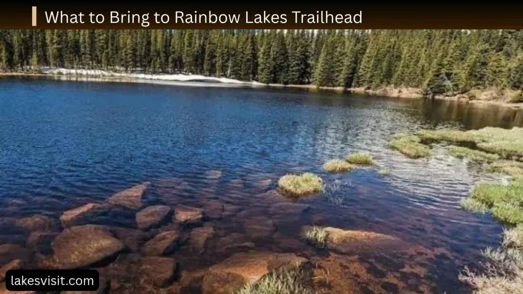
A short hike does not mean you can leave essential gear behind.
Consider bringing:
- Plenty of drinking water
- High-energy snacks
- Offline map
- Phone with downloaded directions
- Portable battery
- Weatherproof layers
- Rain jacket
- Warm layer
- Sunscreen
- Sunglasses
- Hat
- Sturdy hiking shoes
- First-aid supplies
- Headlamp
- Leash and dog supplies
- Fishing equipment and required license if fishing
At roughly 10,000 feet, strong sun and rapidly changing weather can make conditions feel very different from those in Nederland.
Rainbow Lakes Trailhead Safety Tips
Check the Road Before Driving
Do not rely on an old trip report to determine whether Rainbow Lakes Road is currently accessible.
Road conditions can change after storms, snow and heavy rainfall.
Prepare for Limited Cell Service
Save your directions and maps before entering the forest. Recreation.gov specifically warns that connectivity can be limited.
Respect the Altitude
Give yourself time to adjust and do not race up the trail.
If you feel seriously unwell, turn around and seek appropriate help.
Watch the Weather
Mountain weather can change quickly.
Dark clouds, thunderstorms, strong winds, snow or rapidly dropping temperatures are reasons to reconsider continuing.
Start Early
An early start can provide:
- Better parking opportunities
- Cooler temperatures
- More time for unexpected delays
- More flexibility if weather changes
- A quieter experience
Follow Parking Rules
Park only where permitted. A pass does not give permission to park wherever space appears available. Recreation.gov warns that illegal parking can result in fines or towing.
Rainbow Lakes Trailhead vs. Rainbow Lakes Campground
These two names are easy to confuse.
Rainbow Lakes Trailhead is the hiking access point.
Rainbow Lakes Campground is the nearby developed camping area.
The Forest Service places the trailhead east of the campground, while Recreation.gov describes the campground as being at the end of Rainbow Lakes Road.
If you are driving to hike, make sure your navigation destination is specifically Rainbow Lakes Trailhead, not simply Rainbow Lakes Campground.
Who Should Visit Rainbow Lakes Trailhead?
Rainbow Lakes Trailhead is particularly appealing to:
- Hikers wanting a relatively short alpine outing
- Families comfortable with high elevation
- Wildlife watchers
- Landscape photographers
- Anglers
- Backpackers
- Visitors looking for Indian Peaks Wilderness scenery
- Snowshoers and winter recreation users
It may be less suitable for visitors who:
- Have a low-clearance vehicle
- Are not prepared for high elevation
- Expect paved-road access
- Have no navigation backup
- Are visiting without checking weather or road conditions
Rainbow Lakes Trailhead: Quick Planning Guide
If you want to keep the trip simple, use this checklist:
- Check the current Rainbow Lakes Road status.
- Confirm current parking/pass requirements.
- Make sure your vehicle is appropriate for the road.
- Download an offline map.
- Check the high-elevation weather forecast.
- Pack water and food.
- Bring warm and rain layers.
- Keep your dog leashed.
- Arrive early during busy periods.
- Follow Indian Peaks Wilderness regulations.
- Leave no trash behind.
- Give yourself extra time for altitude and changing conditions.
Frequently Asked Questions About Rainbow Lakes Trailhead
Where is Rainbow Lakes Trailhead?
Rainbow Lakes Trailhead is near Nederland, Colorado, in the Boulder Ranger District. It is located east of Rainbow Lakes Campground and provides access to Rainbow Lakes Trail and the Arapaho Glacier Trail.
How long is Rainbow Lakes Trail?
The Forest Service lists the trail as approximately 1.2 miles one way from Rainbow Lakes Trailhead to the last Rainbow Lake. Some mapping services list the complete out-and-back hike at around 2.6 miles.
Is Rainbow Lakes Trail difficult?
It is commonly rated easy based on distance and elevation gain, but the approximately 10,000-foot starting elevation can make the hike more challenging for visitors who are not acclimated.
Do you need a parking pass at Rainbow Lakes Trailhead?
A dedicated Rainbow Lakes Trailhead Day Pass is currently offered through Recreation.gov for the designated parking area. Requirements and fees should be checked before visiting because they can change. The pass does not guarantee a parking space.
Does the parking pass guarantee a parking spot?
No. Recreation.gov explicitly states that purchasing the pass does not guarantee parking availability.
Can dogs go to Rainbow Lakes Trailhead?
Yes. Dogs are allowed, but they must be kept on a hand-held leash according to current Recreation.gov rules.
Is there water at Rainbow Lakes Trailhead?
No drinking water is listed at the trailhead. Colorado’s trail system lists no water, and visitors should bring sufficient water with them.
Is there a bathroom at Rainbow Lakes Trailhead?
Yes. The trailhead has vault toilet facilities.
Can you camp near Rainbow Lakes Trailhead?
Yes. Rainbow Lakes Campground is nearby and currently operates seasonally with 18 first-come, first-served sites. It does not provide drinking water, electricity, hookups or showers.
Is Rainbow Lakes Road open in winter?
Normal vehicle access is seasonal. Recreation.gov states that the road is closed for winter and typically reopens in June. Winter users can instead encounter snowshoeing and cross-country skiing conditions.
What vehicle is best for Rainbow Lakes Road?
A high-clearance vehicle is the safer choice because the road is unpaved and can be rough. Conditions should be checked before travel rather than assuming that any passenger vehicle will be suitable.
Are Rainbow Lakes inside the Indian Peaks Wilderness?
Yes. Rainbow Lakes Trail provides access into the Indian Peaks Wilderness, so visitors should follow applicable wilderness regulations and check permit requirements for overnight trips.
Final Thoughts
Rainbow Lakes Trailhead offers a relatively short route to an impressive high-country landscape near Nederland, Colorado. The combination of alpine lakes, beaver ponds, forest, wildlife habitat and Indian Peaks Wilderness scenery makes it an appealing destination for hikers, families, photographers and outdoor enthusiasts.
The key to a successful visit is preparation. The trail itself is not especially long, but the approximately 10,000-foot elevation, seasonal forest-road access, parking requirements and changing mountain weather deserve serious attention.
Check road conditions and current parking rules before driving in, bring your own water and navigation backup, and plan for conditions rather than relying only on the trail’s “easy” rating. With those considerations handled, Rainbow Lakes Trailhead can be an excellent way to experience Colorado’s high country without committing to a much longer mountain hike.